Near Houston, some Smith Lake listings lead with the woods across the water before they get to the kitchen or the dock. One new build in Slick Ford Phase 1, asking $1.8 million, describes its view over "protected Bankhead National Forest" as "preserved forever." A Penn Brook home listed at $599,000 is marketed as a private waterfront retreat across from the forest.
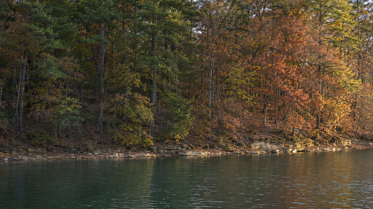
The woods in those listing photos are a working national forest. The Forest Service burns Bankhead on a seasonal schedule, and it has been thinning pine stands since a southern pine beetle outbreak. A buyer touring in December may see a very different far bank than the one in July photos, and the far bank a few years from now may look different again. Anyone weighing a forest-facing home on this side of the lake is also weighing how those woods are managed. The management calendar and the ownership maps are both public, and you can look at them from home before you write an offer.
Where Bankhead Actually Touches the Lake
Smith Lake's western and northern arms run up against the William B. Bankhead National Forest. The Smith Lake Now guide to Lewis Smith Lake lists three Forest Service recreation areas on the water: Clear Creek, Corinth and Houston. The Forest Service puts Clear Creek Recreation Area on Lewis Smith Lake in Winston County, about 13 miles north of Jasper. It places Corinth Recreation Area on the upper part of the lake, also in Winston County.
Between those public sites, the edge of the forest gets harder to see. A local Smith Lake map names Brushy Creek, Rock Creek, Yellow Creek, Clear Creek and the Sipsey Fork, and it draws a Bankhead boundary. It also warns that private and public boundaries inside the forest aren't marked. On a home tour, a wooded bank across a cove off Yellow Creek can look exactly like national forest and still be private acreage.
Listings for private land use "across from Bankhead" too. A 75-acre tract with a Houston address on County Road 56, priced at $3,499,000, has about 4,600 feet of shoreline in what its listing calls a protected cove across from Bankhead National Forest. Its marketing pitches the land as a waterfront subdivision, a private estate or a family compound, and notes that the nearest marinas are about 8 miles away by water. Among forest-facing listings, home prices run from $599,000 to $1.8 million, with that acreage priced above both. The house, the dock and the frontage still set most of the price. Our earlier piece on what drives waterfront prices in Crane Hill covers how depth, slope and shoreline condition separate one lot from another, and those factors apply on the Winston County side as well.
The Woods Across the Cove Burn on a Schedule
Fire is one of Bankhead's regular management tools. The Northwest Alabamian reported in February 2024 that the Bankhead Ranger District planned to burn 18,000 acres that year, about 12,000 of them in Winston County. The paper listed burns already completed that season, including two units named Slick Ford Block E at 138 acres and Slick Ford Block F at 45 acres. Houston was on the list of Winston County locations still planned.
Bankhead District Ranger Andy Scott told the Northwest Alabamian that the burns serve two purposes, fuel reduction and wildlife habitat. He described the habitat goal as "more open forest area where the ground cover is more of the grasses and forbs rather than woody plants." The same article said dormant-season burns were underway in February and growing-season burns would start around April.
That calendar matters for anyone shopping this winter. A showing between now and late spring may come with smoke across the water, a blackened forest floor, or an understory far more open than it looks in summer photos. The stated goal is open woodland with grassy ground cover, so over the years the far bank may look less like a solid green wall. Some buyers will love that and some won't, and it helps to know which kind you are before you fall for a view. The Northwest Alabamian also pointed readers to the Southern Region Prescribed Burn Accomplishment Tracker to follow planned burns and their status.
Pine Beetle Work Added Thinning and Timber Sales
The Forest Service says a southern pine beetle outbreak began on Bankhead in summer 2023 and continued through 2024. Its 2024 response project proposed thinning, restoration and hazardous-fuel reduction. Its listed activities included green timber sales near County Road 63 in Grayson and Moreland, and west of Highway 195 south of Highway 278 near Double Springs. The decision was signed September 27, 2024.
The 2026 Bankhead Forest Health project came next. It aims to manage southern yellow pine stands to reduce the risk of insect damage and catastrophic wildfire, improve wildlife habitat, and return areas to desired conditions. Its analysis began May 4, 2026, and the decision was signed September 28, 2026. The public summary covers Bankhead National Forest as a whole, without stand-by-stand locations.
The Forest Service's latest monitoring report for the National Forests in Alabama, dated July 2026, found Bankhead had the highest southern pine beetle impacts in fiscal 2024. In fiscal 2025, no district in the state met outbreak criteria, though thousands of acres of dead pines still needed assessment and hazard work. Gray standing pines, thinned stands and fresh openings can all change how a ridgeline across the water looks from a deck.
Looking Up the Far Bank Before You Make an Offer
Free public maps show who owns the land across a cove and where the forest boundary runs. Each one answers a different question.
| Tool | What it shows | What it doesn't show |
|---|---|---|
| Winston County Parcel Viewer | Parcels with owner names, plus a USFS category layer | Management plans for any parcel |
| Bankhead National Forest Recreation Map | Forest boundaries and the difference between public and private land | Individual private lot lines |
| Forest Service Interactive Visitor Map | Forest roads, trails, recreation sites and wilderness areas | Parcel ownership |
| Alabama Power Shorelines app | Generator and lake-level notifications, weather and lake news | Who owns the shoreline |
The county parcel viewer is the quickest place to start. Pull up the home you're considering, then click on the land directly across the water and on the parcels on either side of that view. The owner field shows whether you're looking at Forest Service land or a private tract, and the Bankhead recreation map gives you the wider picture of where the forest runs along the arm of the lake you're shopping. Pair that with the burn tracker, and you'll have a good sense of how the view may look in March as well as in July.
Docks bring up their own questions on this lake. Our post on why the dock doesn't come with the house on Arley's side covers what to ask before closing.
A Few Direct Questions
Is the whole Winston County shoreline national forest? No. The forest meets the lake's western and northern arms, but private subdivisions, private acreage and Forest Service land are mixed together along creeks like Yellow Creek, Brushy Creek and Rock Creek. The parcel viewer shows the owner of any specific parcel you're looking at.
Can I still launch a boat at the Forest Service sites in winter? The Forest Service's Corinth page, last updated April 30, 2026, describes the Corinth boat ramp as open year-round and lists a camping season of March 8 through October 31. Its Houston Recreation Area page lists a day-use season of May 5 through September 30, with the campground closed. Our guide to Houston's boat ramp covers how that site runs.
When is burn smoke most likely across the water? In the 2024 season the Northwest Alabamian described, dormant-season burns ran in winter and growing-season burns were expected to begin around April. The Prescribed Burn Accomplishment Tracker shows planned and completed burns.
If you're comparing forest-facing homes around Houston and Double Springs, we're happy to pull the parcel map with you, see who owns the land across each cove, and visit in more than one season so you know how the view changes before you buy. If you already own a home that looks out on Bankhead, Team Sparkman can show you how forest-facing homes compare with the rest of the lake. Request Your Free Home Valuation here.